Localities
Asuküla borehole Show additional data in Estonian Geocollections Portal ID 137 Name Asuküla borehole Loc. type borehole (section) Country Estonia County Lääne County Parish Ridala Elevation (m) 8.00 Latitude (dec. deg.) 58.892652 Longitude (dec. deg.) 23.553706 Coord. precision 1-10 km Coord. method Google Maps / Earth Coord. agent Antonovitš, Liina Location remarks Asub 10 km Haapsalust lõuna pool Vertical extent (m) 138.00 Stratigraphy top Raikküla Stage Stratigraphy base Rakvere Stage Drillcore 22 core boxes Remarks Puuritud TA GI puurbrigaadi poolt u 1958.a J. Muru juhendamisel (E. J. esmakirjeldus 1958 sügis). E. J. 1963 koordin. 58kr52min(=58,86667) ja 23kr33min (=23.55), seega peaks pa olema paar km lõuna pool kui määratud L. Põlma: FIb hüpostratotüüp 82.22-93.71m Record changed 2019-05-27 10:16:22
References (1) Nestor, V. 1994 . Early Silurian chitinozoans of Estonia and North Latvia. Estonian Academy Publishers, Tallinn. 1-163. | DETAILS
Raw data (4 species, 10 samples) locality depth depth_interval sample_number Euconochitina electa Conochitina iklaensis Ancyrochitina bifurcaspina Plectochitina spongiosa
Asuküla borehole 0.80 0.85 M-1318
Asuküla borehole 6.00 6.15 M-1319 1
Asuküla borehole 7.30 7.35 M-1320 1
Asuküla borehole 11.20 M-1321 1 -1 1
Asuküla borehole 13.60 13.65 M-1322 1 -1
Asuküla borehole 15.65 15.70 M-1323 1 1
Asuküla borehole 16.85 16.93 M-1324 1 1
Asuküla borehole 17.40 M-1325 -1 1 1
Asuküla borehole 17.94 18.00 M-1326 1 -1 1
Asuküla borehole 18.20 18.80 M-1327 1
locality	depth	depth_interval	sample_number	Euconochitina electa	Conochitina iklaensis	Ancyrochitina bifurcaspina	Plectochitina spongiosa
Asuküla borehole	0.80	0.85	M-1318
Asuküla borehole	6.00	6.15	M-1319	1
Asuküla borehole	7.30	7.35	M-1320	1
Asuküla borehole	11.20		M-1321	1		-1	1
Asuküla borehole	13.60	13.65	M-1322	1	-1
Asuküla borehole	15.65	15.70	M-1323	1		1
Asuküla borehole	16.85	16.93	M-1324	1		1
Asuküla borehole	17.40		M-1325	-1	1	1
Asuküla borehole	17.94	18.00	M-1326	1	-1	1
Asuküla borehole	18.20	18.80	M-1327	1
Show table
Range chart (autogenerated)
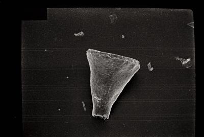
Photos Tooltip: to show larger image hold Ctrl-key when clicking on image.