Localities
Tõlla borehole Show additional data in Estonian Geocollections Portal ID 1236 Name Tõlla borehole Number 1 Loc. type borehole (section) Country Estonia County Pärnu County Parish Saarde Settlement Tõlla Latitude (dec. deg.) 58.177034 Longitude (dec. deg.) 25.117995 Coord. precision 1-10 km Coord. method Google Maps / Earth Coord. agent Antonovitš, Liina Vertical extent (m) 127.00 Stratigraphy top Narva Stage Stratigraphy base Jaani Stage Drillcore 22 core boxes Remarks GI puurauk; H.V. kirjeldanud 120m sügavuseni. Kust on pärit nr 1? Record changed 2018-12-18 13:40:36
References (2) Nestor, V. 1984 . Зональное распределение хитинозой в яаниском горизонте (венлок Эстонии) и проблема его границ [Zonal distribution of chitinozoans in the Wenlockian Jaani Stage of Estonia and the problem of its upper boundary]. Стратиграфия древнепалеозойских отложений Прибалтики [Stratigrafiâ drevnepaleozojskih otloženij Pribaltiki]. Eesti NSV Teaduste Akadeemia, Tallinn. 119-127. | DETAILS
Nestor, V. 1994 . Early Silurian chitinozoans of Estonia and North Latvia. Estonian Academy Publishers, Tallinn. 1-163. | DETAILS
Raw data (19 species, 10 samples) locality depth depth_interval sample_number Conochitina alargada Conochitina praeproboscifera Conochitina elongata Conochitina iklaensis Eisenackitina dolioliformis Angochitina longicollis Margachitina banwyensis Conochitina emmastensis Ramochitina ruhnuensis Conochitina visbyensis Eisenackitina inanulifera Conochitina proboscifera Eisenackitina causiata Conochitina aff. tuba Margachitina margaritana Calpichitina densa Plectochitina pachyderma Conochitina claviformis Conochitina mamilla
Tõlla borehole 117.40 117.45 M-9194
Tõlla borehole 118.90 119.00 M-9193 1 1
Tõlla borehole 120.85 120.95 M-9192 1 1 1
Tõlla borehole 122.20 122.25 M-9191 1 1 1 -1 1 1
Tõlla borehole 123.45 123.50 M-9190 1 1 1 1 1 1 1 -1
Tõlla borehole 125.20 125.25 M-9189 -1 1 1 1
Tõlla borehole 126.10 126.40 M-9188 1 1 -1 1 1 1 1 1 1
Tõlla borehole 128.60 128.70 M-9187 -1 1 -1 1
Tõlla borehole 130.95 131.10 M-9186 -1 1 -1 1
Tõlla borehole 132.95 133.05 M-9185 -1 -1 -1
locality	depth	depth_interval	sample_number	Conochitina alargada	Conochitina praeproboscifera	Conochitina elongata	Conochitina iklaensis	Eisenackitina dolioliformis	Angochitina longicollis	Margachitina banwyensis	Conochitina emmastensis	Ramochitina ruhnuensis	Conochitina visbyensis	Eisenackitina inanulifera	Conochitina proboscifera	Eisenackitina causiata	Conochitina aff. tuba	Margachitina margaritana	Calpichitina densa	Plectochitina pachyderma	Conochitina claviformis	Conochitina mamilla
Tõlla borehole	117.40	117.45	M-9194
Tõlla borehole	118.90	119.00	M-9193																		1	1
Tõlla borehole	120.85	120.95	M-9192															1		1	1
Tõlla borehole	122.20	122.25	M-9191											1	1	1	-1	1			1
Tõlla borehole	123.45	123.50	M-9190											1	1	1	1	1	1	1	-1
Tõlla borehole	125.20	125.25	M-9189										-1		1		1	1
Tõlla borehole	126.10	126.40	M-9188					1	1	-1	1	1	1	1	1	1
Tõlla borehole	128.60	128.70	M-9187	-1	1	-1	1
Tõlla borehole	130.95	131.10	M-9186	-1	1	-1	1
Tõlla borehole	132.95	133.05	M-9185	-1	-1	-1
Show table
Range chart (autogenerated)
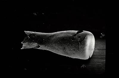
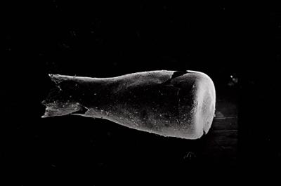
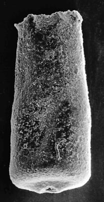
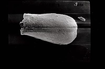
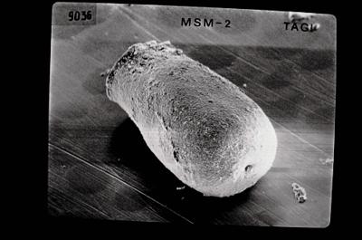
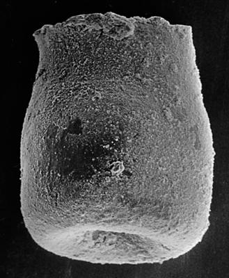
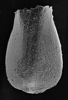
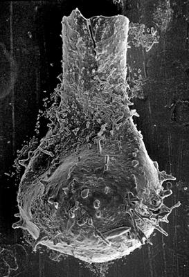
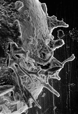
Photos