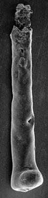
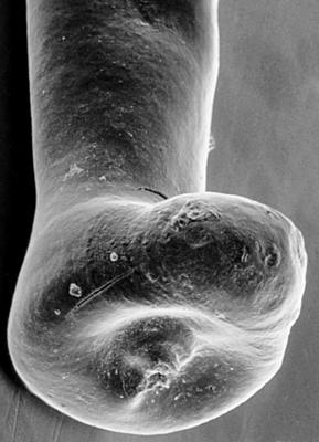
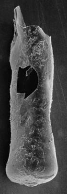
Localities
... or show all sections
Ninase cliff
Show additional data in Estonian Geocollections Portal
|
References (3)
Nestor, V. 1984. Зональное распределение хитинозой в яаниском горизонте (венлок Эстонии) и проблема его границ [Zonal distribution of chitinozoans in the Wenlockian Jaani Stage of Estonia and the problem of its upper boundary]. Стратиграфия древнепалеозойских отложений Прибалтики [Stratigrafiâ drevnepaleozojskih otloženij Pribaltiki]. Eesti NSV Teaduste Akadeemia, Tallinn. 119-127. | DETAILS
Nestor, V. 1991. On the distribution of aberrant forms of chitinozoans in the Silurian of Estonia and West Latvia. Proceedings of the Estonian Academy of Sciences. Geology 40 (3), 96-99. | DOI | DETAILS
Nestor, V. 1994. Early Silurian chitinozoans of Estonia and North Latvia. Estonian Academy Publishers, Tallinn. 1-163. | DETAILS
Photos
Tooltip: to show larger image hold Ctrl-key when clicking on image.