Localities
Kaldase 60 borehole
Show additional data in Estonian Geocollections Portal| ID | 15807 |
|---|
| Name | Kaldase 60 borehole |
|---|
| Number | 60 |
|---|
| Loc. type | borehole (section) |
|---|
| Country | Estonia |
|---|
| County | Harju County |
|---|
| Parish | TALLINN |
|---|
| Latitude (dec. deg.) | 59.462306 |
|---|
| Longitude (dec. deg.) | 24.935847 |
|---|
| Coord. precision | 100-1000 m |
|---|
| Coord. method | Est Land Board map server |
|---|
| Coord. agent | Aaloe, Aasa |
|---|
| Location remarks | Iru Ämmast ida pool paekalda servas, pa-st 45 1,2 km läänes, kõrgusmärgi "Nehatu torn" vahetus läheduses. Puuritud Iru-Muuga tee (uus ringtee) rekonstrueerimiseks. |
|---|
| Vertical extent (m) | 18.60 |
|---|
| Stratigraphy top | Lasnamägi Stage |
|---|
| Stratigraphy base | Tremadocian |
|---|
| Drillcore | 3 core boxes |
|---|
| Remarks | REI puurauk. Kaldase oli kunagine talu. Praegu tänav Tallinnas (Maardus?) - ühendab Vana-Narva mnt-d Muuga suvilarajooniga. Koordinaadid asukoha kirjelduse järgi. |
|---|
| Record inserted | 2011-04-06 15:29:42 |
|---|
| Record changed | 2017-05-10 16:11:44 |
|---|
|
|
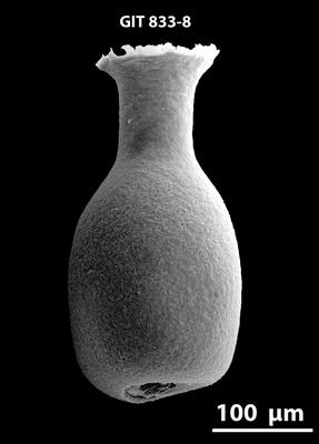
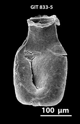
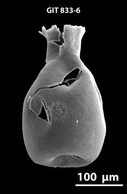
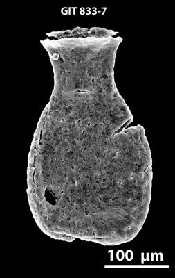
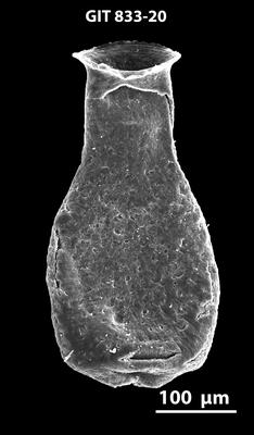
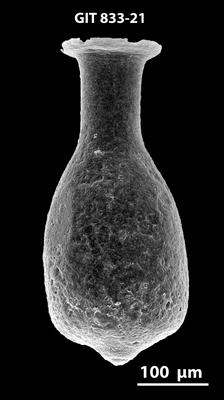
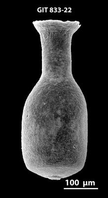
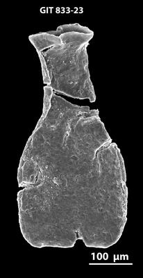
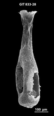
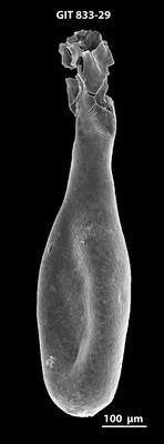
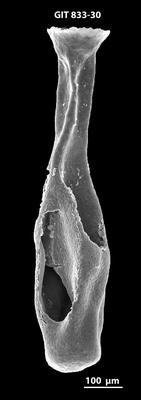
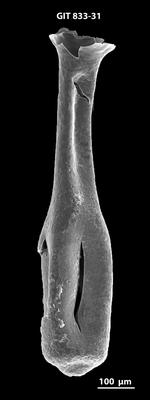
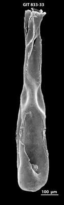
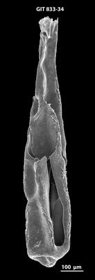
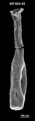
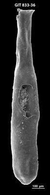
Photos