Localities
Taagepera borehole
Show additional data in Estonian Geocollections Portal| ID | 1332 |
|---|
| Name | Taagepera borehole |
|---|
| Number | 1 |
|---|
| Loc. type | borehole (section) |
|---|
| Country | Estonia |
|---|
| County | Valga County |
|---|
| Parish | Helme |
|---|
| Settlement | Taagepera |
|---|
| Elevation (m) | 90.00 |
|---|
| Latitude (dec. deg.) | 57.993879 |
|---|
| Longitude (dec. deg.) | 25.668907 |
|---|
| X (m, L-EST 97) | 6429281 |
|---|
| Y (m, L-EST 97) | 598694 |
|---|
| Coord. agent | Eesti Geoloogiakeskus (EGK) |
|---|
| Location remarks | Asub Taageperast põhja pool, Ala külast u 2 km lõunas (L. P. päevik 5) |
|---|
| Vertical extent (m) | 596.40 |
|---|
| Stratigraphy top | Burtnieki Stage |
|---|
| Stratigraphy base | Proterozoic |
|---|
| Maaamet ID | 1088 |
|---|
| Remarks | Hüdrogeol puurauk. EGF 3912 |
|---|
| Record changed | 2022-11-21 21:13:25 |
|---|
|
|
Raw data (13 species, 20 samples)
locality	depth	depth_interval	sample_number	Spinachitina fragilis	Belonechitina postrobusta	Belonechitina aspera	Ancyrochitina laevaensis	Plectochitina nodifera	Plectochitina spongiosa	Cyathochitina kuckersiana	Cyathochitina campanulaeformis	Cyathochitina calix	spinachitina harringtoni	Euconochitina electa	Ancyrochitina bifurcaspina	Conochitina iklaensis
Taagepera borehole	365.80		M-10495								-1			1		1
Taagepera borehole	366.30	366.40	M-10494							1				1	1	1
Taagepera borehole	367.30	367.40	M-10493							1				1	1	1
Taagepera borehole	368.80	368.90	M-10492							1	1			1	1	1
Taagepera borehole	370.10	370.20	M-10491											1	1	1
Taagepera borehole	373.00	373.10	M-10490		1	-1				1	-1				1	1
Taagepera borehole	375.40	375.50	M-10489		1	1				1	-1			1	1
Taagepera borehole	377.60	377.70	M-10488		1						1
Taagepera borehole	379.70		M-10487		1	1				1	-1	1		-1	1
Taagepera borehole	381.40		M-10486		1							-1	-1	-1
Taagepera borehole	384.00	384.10	M-10485		1						1	1	-1	1
Taagepera borehole	386.20	386.30	M-10484								1	1
Taagepera borehole	390.40	390.50	M-10482	1							1	1
Taagepera borehole	394.80	394.90	M-10480	-1					1			1
Taagepera borehole	397.00	397.05	M-10479
Taagepera borehole	400.00		M-10478	1							1	-1
Taagepera borehole	401.50	401.60	M-10477		-1			-1
Taagepera borehole	408.80	408.90	M-10476	1			1	1	1	-1	1
Taagepera borehole	410.70	410.80	M-10475	-1	-1	1
Taagepera borehole	410.95	411.00	M-10474	-1
| locality | depth | depth_interval | sample_number | Spinachitina fragilis | Belonechitina postrobusta | Belonechitina aspera | Ancyrochitina laevaensis | Plectochitina nodifera | Plectochitina spongiosa | Cyathochitina kuckersiana | Cyathochitina campanulaeformis | Cyathochitina calix | spinachitina harringtoni | Euconochitina electa | Ancyrochitina bifurcaspina | Conochitina iklaensis |
|---|
| Taagepera borehole | 365.80 | | M-10495 | | | | | | | | -1 | | | 1 | | 1 |
| Taagepera borehole | 366.30 | 366.40 | M-10494 | | | | | | | 1 | | | | 1 | 1 | 1 |
| Taagepera borehole | 367.30 | 367.40 | M-10493 | | | | | | | 1 | | | | 1 | 1 | 1 |
| Taagepera borehole | 368.80 | 368.90 | M-10492 | | | | | | | 1 | 1 | | | 1 | 1 | 1 |
| Taagepera borehole | 370.10 | 370.20 | M-10491 | | | | | | | | | | | 1 | 1 | 1 |
| Taagepera borehole | 373.00 | 373.10 | M-10490 | | 1 | -1 | | | | 1 | -1 | | | | 1 | 1 |
| Taagepera borehole | 375.40 | 375.50 | M-10489 | | 1 | 1 | | | | 1 | -1 | | | 1 | 1 | |
| Taagepera borehole | 377.60 | 377.70 | M-10488 | | 1 | | | | | | 1 | | | | | |
| Taagepera borehole | 379.70 | | M-10487 | | 1 | 1 | | | | 1 | -1 | 1 | | -1 | 1 | |
| Taagepera borehole | 381.40 | | M-10486 | | 1 | | | | | | | -1 | -1 | -1 | | |
| Taagepera borehole | 384.00 | 384.10 | M-10485 | | 1 | | | | | | 1 | 1 | -1 | 1 | | |
| Taagepera borehole | 386.20 | 386.30 | M-10484 | | | | | | | | 1 | 1 | | | | |
| Taagepera borehole | 390.40 | 390.50 | M-10482 | 1 | | | | | | | 1 | 1 | | | | |
| Taagepera borehole | 394.80 | 394.90 | M-10480 | -1 | | | | | 1 | | | 1 | | | | |
| Taagepera borehole | 397.00 | 397.05 | M-10479 | | | | | | | | | | | | | |
| Taagepera borehole | 400.00 | | M-10478 | 1 | | | | | | | 1 | -1 | | | | |
| Taagepera borehole | 401.50 | 401.60 | M-10477 | | -1 | | | -1 | | | | | | | | |
| Taagepera borehole | 408.80 | 408.90 | M-10476 | 1 | | | 1 | 1 | 1 | -1 | 1 | | | | | |
| Taagepera borehole | 410.70 | 410.80 | M-10475 | -1 | -1 | 1 | | | | | | | | | | |
| Taagepera borehole | 410.95 | 411.00 | M-10474 | -1 | | | | | | | | | | | | |
Show table
Range chart (autogenerated)
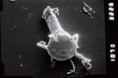
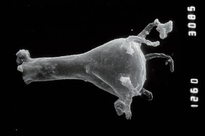
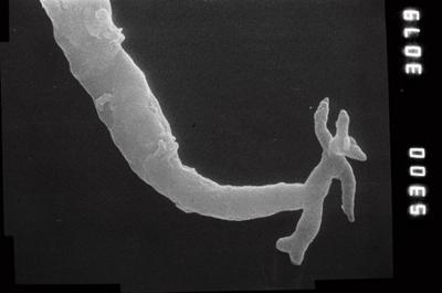
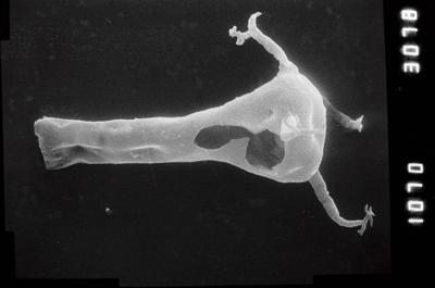
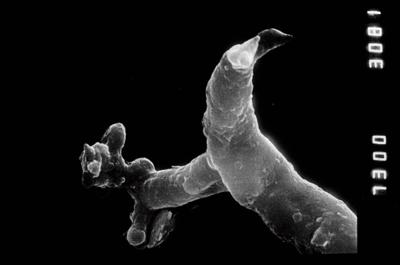
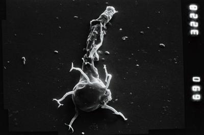
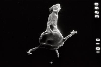
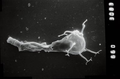
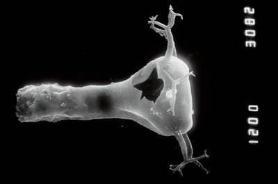
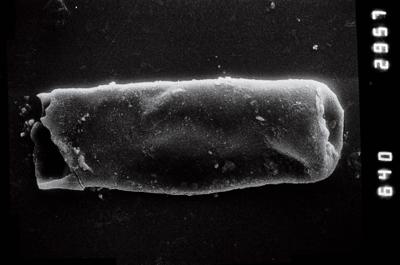
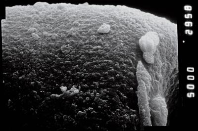
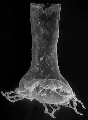
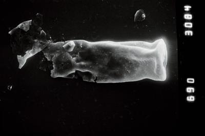
Photos